MELSETTER
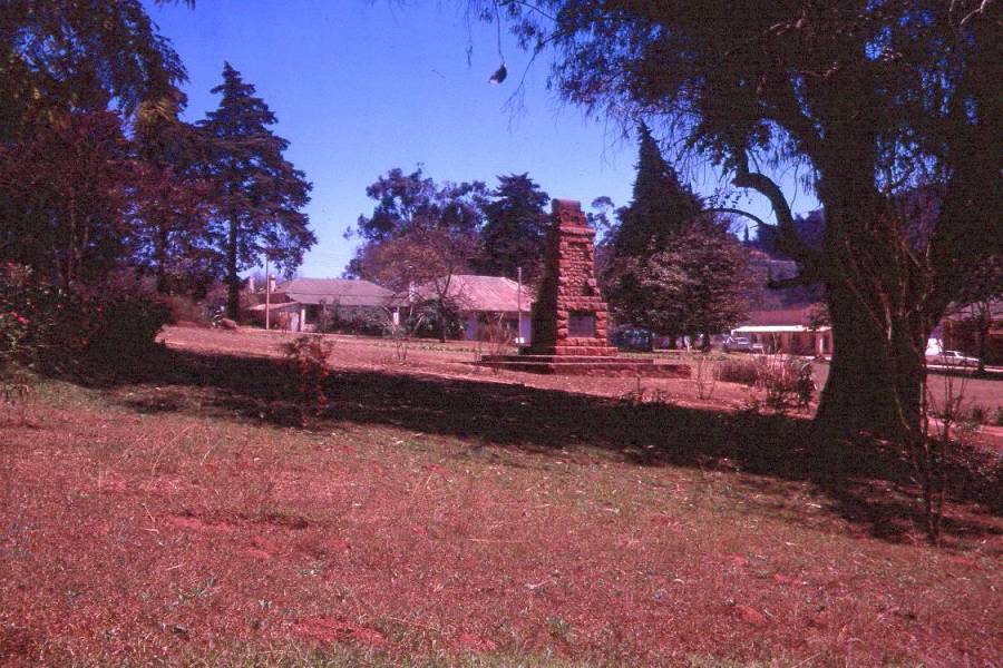
Photo taken by Mort Poultney August 1973
Rhodesian Place Names
MELSETTER
Photo taken by Mort Poultney August 1973
Latitude 19° 48' S,
Longitude 32° 52' E, Altitude 1,586 m
(5,234 ft), Rainfall 1300 mm (52 inches)
The Melsetter district was originally bounded on the east by
Mozambique, on the north and north-west by the Umtali district
and west and south-west by the districts of Charter, Bikita and
Ndanga, from which it was divided by the Sabi river. Its total
area was 800 000 hectares, but it was later split when the
Chipinga district was formed, leaving only 310 000 hectares. The
area consists of a series of broken plateaux of various
altitudes, on the central one of which the township of Melsetter
is situated. The land falls west and south, and the
Chimanimani
mountains, with peaks rising to a height of about 2,450 metres
(8,085 ft), form part of the Mozambique boundary. In the extreme
south the elevation is only 300 metres, being at the junction of
the Sabi and Lundi rivers. The low country is somewhat unhealthy,
but elsewhere the climate is extremely salubrious.
The district contains a number of old ruins which follow the
Zimbabwe pattern, and there are also some bushman paintings near
the old drift, across the Sabi river.
There were originally three 'Melsetters'. Steynstroom was renamed
North Melsetter in 1911, but this place closed down in 1930.
Central Melsetter is the present Melsetter and South Melsetter
became the site of the present Chipinga.
Dunbar Moodie, a nephew of Tom Moodie who led the first settlers
to Gazaland, took it upon himself to organise the district. He
appointed his uncle as sheriff, and his son became the first
postmaster of Melsetter.
The Melsetter of today, is a delightful village, situated 152
kilometres from Umtali in the foothills of the Chimanimani
mountains. It was originally occupied by the Vadao people, who
spoke the Tshindao language, which was spoken and understood
through a wide radius down into the flats of Mozambique, and up
nearly as far as Umtali. The village is the site of one of the
earliest European settlements in Rhodesia. One of Rhodes' first
tasks after the occupation of Mashonaland was to settle the
eastern districts, for although a treaty was signed in June 1891
between Great Britain and Portugal settling the borders of the
disputed territories, the Portuguese still resented the loss of
land in Manicaland and Gazaland which they considered falling
within their sphere of influence. To reinforce his position,
Rhodes obtained a concession from Chief Gunganyana, who sent two
of his indunas to London to tender allegiance to the Queen.
Rhodes believed it was essential to his plans of occupying
Manicaland, to establish a European settlement and he obtained
the services of George Benjamin Dunbar Moodie to recruit farmers
from the Orange Free State, with the offer of a 3 000 morgen farm
in Gazaland to every man and boy who could trek to the Eastern
districts.
Dunbar Moodie contacted his uncle, Thomas Moodie, a maize and
wheat grower in the Bethlehem district of the Free State, whose
ancestors had been tenant farmers at Melsetter in the Orkneys.
After some bargaining with Rhodes regarding the terms of land
tenure, Thomas Moodie organised a party of 29 families consisting
of 37 men and 31 women, with 17 wagons and 350 horses and cattle.
They were mostly Afrikaans speaking farmers and the party set off
in May 1892.
After many misadventures, such as the outbreak of foot and mouth
disease among the cattle at Macloutsi, attacks by lions and the
shortage of water, they eventually reached Fort Victoria, where
dissention broke out among them when they realised they were
having to go to a virtually unkown country, instead of to the
north, where other Europeans had already settled. Most of the
trekkers rejected Moodie's leadership, and made their way
northwards and settled at Enkeldoorn and Salisbury. With only
seven wagons left, and 14 men, four women and three small
children, Moodie set off to open a new tract of the country. The
thick bush and hilly terrain often hampered progress and
sometimes the wagons had to outspan for as long as four days
while the men cut, dug and dynamited a path through the rocks and
thick trees. Then they reached the Sabi, a wide sandy bedded
river, rumoured to be treacherous with quicksands. Thomas Moodie
went ahead on his horse from island to island in the shallow
river to mark out a safe and firm path for the wagons.
Then horse sickness struck the horses and malaria the men. Soon
after crossing the Sabi they came across a great mountain barrier
which they could only climb by chaining three teams of oxen to
each wagon. Thousands of drops of perspiration rolled down that
mountain during the four days it took to get the wagons to the
top of the mountain which they called ‘Threespansberg’.
At last, on January 3, 1893, nine months after leaving Bethlehem,
they reached the green rolling hills of the present Chipinga
district. They halted by three clear waterfalls, the spot where
Thomas Moodie claimed his own farm, to which he gave the name
‘Waterfall’.
Many were the struggles before the settlers established
themselves, and other parties, including the Martin and Edenburg
treks, followed after Moodie had blazed the trail. Although
Thomas Moodie survived long enough to see the site of Melsetter
pegged out, he died of blackwater fever within a year of his
arrival. A memorial was erected on the farm he claimed and his
grave is surrounded by some of the most attractive country in
Rhodesia.
Melsetter was the worst hit with tragedy in these early days.
Apart from the death of Thomas Moodie, many settlers died and
suffered severe hardships and deprivation. Red water fever and
later the rinderpest claimed most of their stock. Perhaps one of
the saddest stories in Rhodesian history is the fate that befell
the Martin trek. This party under Martinus Martin left the Orange
Free State in April 1894 and included 16 women and a number of
children.
The leader was a very religious man, and no travelling was
undertaken on Sundays. At the Nuanetsi river one of the ladies, a
Mrs. Scholtz, died of malaria fever, and when they arrived at
their destination a large proportion of the party was suffering
from the same disease. They were so ill, that they could not be
shown their boundaries. Having lost most of their cattle through
red water fever, they were unable to plough, and the seeds they
were able to sow were washed out by the torrential rains of the
1895 season.
Tragedy also struck the Herselman family. Their twelve year-old
daughter, while looking after the cattle, got soaked when
crossing a river. She contracted fever and died, but before she
could be buried, her mother also died, and the father was so ill
be became unconscious. Two remaining children, who were also sick
had to dig a shallow grave to bury their mother and sister. Soon
the father too, passed away - half the family of eight dying in
one month. More died and there were no coffins and in most cases
the bodies were just wrapped in blankets and committed to the
earth.
The Moodies had to feed and clothe a number of the new arrivals,
who were required to turn out as burghers for the B.S.A. Company.
A Portuguese expedition came to hoist their flag and take
possession of the area, and Dunbar Moodie organised a force of
some 20 burghers to intercept them. He was at that time
Administrator, Postmaster, J.P. and Native Commissioner of the
district.
In 1895 Mrs. Thomas Moodie left the country, ruined in health and
having lost all she had. Dunbar Moodie's family fared no better.
Although he had done much for the people of the district he ran
foul of the authorities and was arrested for gun running. Prior
to this episode the Company had granted him nine farms from where
he made a road to Umtali - but the hardships of living under
these conditions ruined his health. Many settlers left Melsetter
and blamed him for misleading them. In 1897 Dunbar became ill,
and so did two of his children. Mrs. Moodie had just given birth
to their third child, and when it was only a few weeks old, her
husband died. He wrote a will, but as it was not witnessed, it
was declared invalid. Consequently, all the farms, except the one
on which she was living were confiscated, and repossessed by the
B.S.A. Company.
The District was officially defined in 1895, when a magistrate
and Native Commissioner were appointed. W. M. Longden, who had
previously been attached to the kraal of Chief Gunganyana, was
the first local to hold this post and his first task was the
arrest of Dunbar Moodie for gun running, and the next to move the
township to its present site. The residency was then a pole and
dagga hut, but when Rhodes visited the area in 1897, he insisted
on proper Government buildings being constructed, some of which
remain to this day.
Return to Rhodesian Place Names
Visit the
Chimanimani and Outward Bound web site
Most of the information on this page is
extracted from the books :
"Avondale to Zimbabwe" written and published by R.
Cherer Smith ISBN 0-7974-0313-2 and
"Tabex Encyclopedia Zimbabwe" © Quest Publishing
ISBN 0-908306-04-0
with additional notes and photographs by the webmaster and other
contributors as acknowledged.