NYAMANDHLOVU
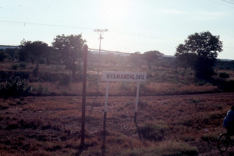
This picture was taken early one morning in 1986 as we were heading north to Victoria Falls
on a steam train excursion - by Gordon Poultney.
Rhodesian Place Names
NYAMANDHLOVU
This picture was taken early one morning in 1986 as we were heading north
to Victoria Falls
on a steam train excursion - by Gordon Poultney.
Latitude 19° 52' S, Longitude 28° 15' E, Altitude 1,219 m (4,025 ft), Rainfall
600 mm (20 inches)
Nyamandhlovu, a railway station and District Commissioner's headquarters, is
situated 50 km from
Bulawayo
on the Victoria Falls railway line. The name means 'flesh of the elephant' in
the Sindebele vernacular. The area was once the habitat of large herds of
elephant that were sought by ivory hunters, but which ultimately found sanctuary
in the Wankie Game Reserve.
It has been asserted that the name was given in honour of one of Lobengula's
regiments, but old Africans claim that the name has nothing to do with the
regiment. They say that Mzilikazi, on his journey north, divided his houses and
the King took a westerly route past the Makarikari salt pans in Botswana; here
he met one of his Indunas named Gundwane, the leader of the other party who had
entered the country via Matopos. He was accompanied by the King's son Nkulumana
(so named after Kuruman, the station where Robert Moffat, friend of Mzilikazi
worked amongst the African people). Gundwane guided the King to Ntabazinduna (a
hill near
Bulawayo).
On their journey they passed through the area now known as Tjolotjo and
Nyamandhlovu and somewhere along the way they saw a pan shaped like the head of
an elephant which they called Shololezhowa meaning the 'head of an elephant'.
Whereupon Mzilikazi named the whole area 'e'Nyamandhlovu'.
The area has developed into an important cattle and dairy district, and the
village has become an important distribution centre for the local farmers, some
of whom are probably among the most progressive in Matabeleland. The indigenous
breed of cattle 'Nkone' are located in the area and were introduced by the
Matabele on their northward migration. A research station at Nyamandhlovu
conducts studies in beef cattle systems of production and other aspects of
livestock research.
The district covers an area of about 90 km from north to south and about 180 km
from east to west. It is bounded on the south-east by the Bulawayo district and
on the east by the Bubi district. On the south-west it is bounded by the
Bulalima-Mangwe district and on the west by Botswana, and the
Wankie Game
Reserve stretches across its northern boundary.

Return to Rhodesian Place Names
Most of the information on this page is
extracted from the books :
"Avondale to Zimbabwe" written and published by R.
Cherer Smith ISBN 0-7974-0313-2 and
"Tabex Encyclopedia Zimbabwe" © Quest Publishing
ISBN 0-908306-04-0
with additional notes and photographs by the webmaster and other
contributors as acknowledged.